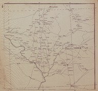
Route Map (Carte Routière) of the Syrian and Lebanese coast region between the cities of Tripoli (Lebanon) and Latakia (Syria).
Files
File Description SizeFormat 
AFMSRPLA004.jpg4.33 MBJPEG
Title
Route Map (Carte Routière) of the Syrian and Lebanese coast region between the cities of Tripoli (Lebanon) and Latakia (Syria).
Creator
‘Bureau Topographique de l’Armée Française du Levant’ (Topographic Office of French Army in the East)
Description
Route Map (Carte Routière) of the northern region of Iraq. The cities of Duhok, Rawanduz and Mosul are indicated on the map. The map has been drawn by the ‘Bureau Topographique de l’Armée Française du Levant’ (Topographic Office of French Army in the East) and it is the fourth of a series of 12 maps concerning the Iraqi and Syrian road and railway system according with the scheme placed on map n. 12.
Issue Date
1924-11
Language
French
Location
SALT Research
URI
https://archives.saltresearch.org/handle/123456789/29999
Collections
Type
Map
Format
52,5-48 cm, Printed
Identifier
AFMSRPLA004
Rights
Open Access
Rights Holder
Rachel Adrienne Sarrou
Accrual Method
Donation

RIGHTS STATEMENT

Salt is a partner of Flickr Commons. All visual materials within Flickr Commons and digitized by Salt Research which are accessible via saltresearch.org are shared under the Creative Commons license:

This material is provided solely for the purpose of individual research. It can be used under Creative Commons Attribution-NonCommercial-NoDerivatives 4.0 International (CC BY-NC-ND 4.0) license. The terms specified hereunder:

• The creator or the licensor of the work should be stated in all copies,
• Copies of documents, or documents created from copies can not be used commercially,
• Documents can not be remixed, transformed or built upon.

For each use, credits should be given as stated in the record.
(e.g. Salt Research, Harika-Kemali Söylemezoğlu Archive)

For any rights requests outside of personal research purposes, please contact Salt Research via salt.research@saltonline.org