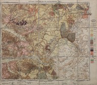
Geologische Karte des westlichen Kleinasien. Blatt 4. (Maßstab 1:300000) - Batı Anadolu jeolojik haritası. Pafta 4 (Ölçek 1:300000) - Geological map of western Asia Minor. Sheet 4 (Scale 1:300000)
| Dublin Core Alanı | Değer | Dil |
|---|---|---|
| dc.contributor | Leitung: Prof. Paul Langhans | |
| dc.creator | A. Philippson | |
| dc.date.accessioned | 2018-09-23T11:58:49Z | - |
| dc.date.available | 2018-09-23T11:58:49Z | - |
| dc.date.issued | 1913 | |
| dc.identifier | APLAPH004 | |
| dc.identifier.other | 108068 | |
| dc.identifier.uri | https://archives.saltresearch.org/handle/123456789/114905 | - |
| dc.description | Isohypsen von 100 m Abstand, von 500 zu 500 m stärker ausgezogenen. 100 metre aralıkla alınmış izohipslerin 500 metrede bir atlanmasıyla oluşturulmuştur. Isohips with 500 m distance, skipped every 500 meters | |
| dc.format | 75-65 cm | |
| dc.format | Baskı-Renkli - Printing-Colored | |
| dc.language | Almanca - German | |
| dc.publisher | Justus Perthes | |
| dc.rights | Open Access | |
| dc.title | Geologische Karte des westlichen Kleinasien. Blatt 4. (Maßstab 1:300000) - Batı Anadolu jeolojik haritası. Pafta 4 (Ölçek 1:300000) - Geological map of western Asia Minor. Sheet 4 (Scale 1:300000) | |
| dc.type | Harita - Map | |
| dc.location | SALT Research | |
| dc.catalogedby | Sinem Gülmez | |
| dc.date.cataloged | 2012-07-30 | |
| dc.format.numberofscans | 1 | |
| dc.format.numberofpages | 1 | |
| dcterms.accrualMethod | Satın alma - Purchase | |
| Koleksiyonlar | A. Philippson | |
Dosyalar
| Dosya | Tanım | Boyut | Biçim | |
|---|---|---|---|---|
| APLAPH004.jpg | 13.65 MB | JPEG |


