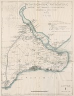
A map of the land fortification of medieval Constantinople with inscriptions on them and the surrounding churches and monasteries prepared and elaborated by M. Is. N. Series of Byzantines studies
| Dublin Core Alanı | Değer | Dil |
|---|---|---|
| dc.date.accessioned | 2018-09-21T19:08:58Z | - |
| dc.date.available | 2018-09-21T19:08:58Z | - |
| dc.date.issued | 1938 | - |
| dc.identifier | APLMISN03 | - |
| dc.identifier.uri | https://archives.saltresearch.org/handle/123456789/103334 | - |
| dc.format | 88-68 cm | - |
| dc.language | Yunanca - Greek | - |
| dc.rights | Local Access | - |
| dc.title | A map of the land fortification of medieval Constantinople with inscriptions on them and the surrounding churches and monasteries prepared and elaborated by M. Is. N. Series of Byzantines studies | - |
| dc.type | Harita - Map | - |
| dc.location | St. Pierre Church | - |
| dc.identifier.projectcode | SPC | - |
| dc.catalogedby | Hilal Aktaş | - |
| dc.date.cataloged | 2007-08-13 | - |
| dc.date.acquisition | 2007-08-13 | - |
| dc.format.numberofscans | 2 | - |
| dcterms.accrualMethod | Borrowed | - |
| Koleksiyonlar | A. M. Schneider - M. Is. Nomidis | |
Dosyalar
| Dosya | Tanım | Boyut | Biçim | |
|---|---|---|---|---|
| APLMISN03.jpg | 1.67 MB | JPEG | ||
| APLMISN03E001.jpg | 1.34 MB | JPEG |